
Magelang, July 7, 2026 – The Bachelor of Applied Science Program in Geographic Information System (GIS), Department of Earth Technology, Sekolah Vokasi (School of Applied Sciences), Universitas Gadjah Mada (DTK SV UGM), collaborated with PT Inderaja Teknik Indonesia to utilize Light Detection and Ranging (LiDAR) technology mounted on an Unmanned Aerial Vehicle (UAV) to support the development of the 2026 Sumberarum Village Map in Tempuran District, Magelang Regency.
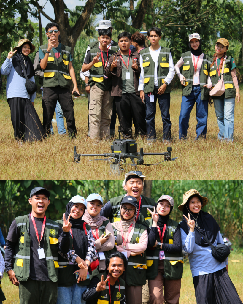
The collaboration integrates hands-on student learning, advanced geospatial technology, and community engagement to produce accurate spatial information that can support village development planning and local resource management.
The LiDAR data acquisition was conducted on Tuesday, July 7, 2026, as part of the second day of Fieldwork Practice 2: Data Acquisition and Mapping (PKL 2). Through this academia–industry collaboration, students gained direct experience in applying geospatial technologies used in professional surveying and mapping practices.The activity also contributes to research and community engagement initiatives undertaken by Sekolah Vokasi in Sumberarum Village. By integrating UAV-based LiDAR data with other field survey data, the program aims to generate reliable and comprehensive geospatial information that can serve as a basis for evidence-based village planning and sustainable regional development.
Working in groups, the students conducted a range of data acquisition activities, including geodetic GNSS surveys to delineate hamlet boundaries, land-use surveys, building block mapping, demographic surveys, and aerial data acquisition using UAVs. The collected data will be integrated to produce accurate geospatial information, supporting the planning, development, and management of Sumberarum Village.
The partnership with PT Inderaja Teknik Indonesia was implemented through UAV-based LiDAR data acquisition. The activity is part of the 2026 Community Service Grant funded by Sekolah Vokasi (School of Applied Sciences), Universitas Gadjah Mada, under two projects: “LiDAR Remote Sensing Data Acquisition Using Unmanned Aerial Vehicles in the Northern and Southern Areas of Sumberarum Village, Tempuran District, Magelang Regency” and “Current Land Use Mapping Using LiDAR Data in the Northern and Southern Areas of Sumberarum Village, Tempuran District, Magelang Regency.”
Through this collaboration, students gained firsthand experience in applying LiDAR technology to surveying and mapping activities. LiDAR technology can produce high-resolution elevation data that can support various applications, including spatial analysis, land-cover identification, terrain modelling, and the production of highly accurate and precise maps.
Dr. Taufik Hery Purwanto, S.Si., M.Si., Secretary of the Department of Earth Technology, Sekolah Vokasi (School of Applied Sciences), Universitas Gadjah Mada, and ex officio Head of the Bachelor of Applied Science Program in Geographic Information System, stated that PKL 2 was designed to provide students with direct learning experience through the application of geospatial technologies used in professional practice.
“Fieldwork enables students to integrate the knowledge they have gained in the classroom with practical experience in the field. Through collaboration with industry partners, students not only learn the technical aspects of surveying and mapping but also understand the importance of data quality in producing reliable geospatial information,” he said.
In addition to strengthening students’ technical competencies, the activity also enhanced collaboration among the university, industry partners, the village government, and the local community in supporting the provision of high-quality geospatial data. The acquired data is expected to serve as a foundation for village development planning, local resource management, and future research and community service activities.
For the students, participating in the entire survey process provided valuable insight into the extensive work involved in producing a map. Every coordinate measured, every aerial image captured, and every field observation recorded contributes to the production of accurate and reliable geospatial information.
Through PKL 2, Bachelor of Applied Science Program in Geographic Information System, DTK SV UGM, remains committed to producing graduates with academic competence, professional skills, and experience relevant to developments in geospatial technology. Collaboration with various strategic partners is expected to strengthen the implementation of the Tri Dharma Perguruan Tinggi (Three Pillars of Higher Education), while also making a real contribution to geospatial data-based development.
Author: Department of Earth Technology Media & Communications Team
Photography: Department of Earth Technology Media & Communications Team (2026)