
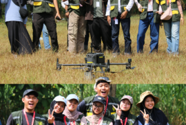
Magelang, July 7, 2026 – The Bachelor of Applied Science Program in Geographic Information System (GIS), Department of Earth Technology, Sekolah Vokasi (School of Applied Sciences), Universitas Gadjah Mada (DTK SV UGM), collaborated with PT Inderaja Teknik Indonesia to utilize Light Detection and Ranging (LiDAR) technology mounted on an Unmanned Aerial Vehicle (UAV) to support the development of the 2026 Sumberarum Village Map in Tempuran District, Magelang Regency.