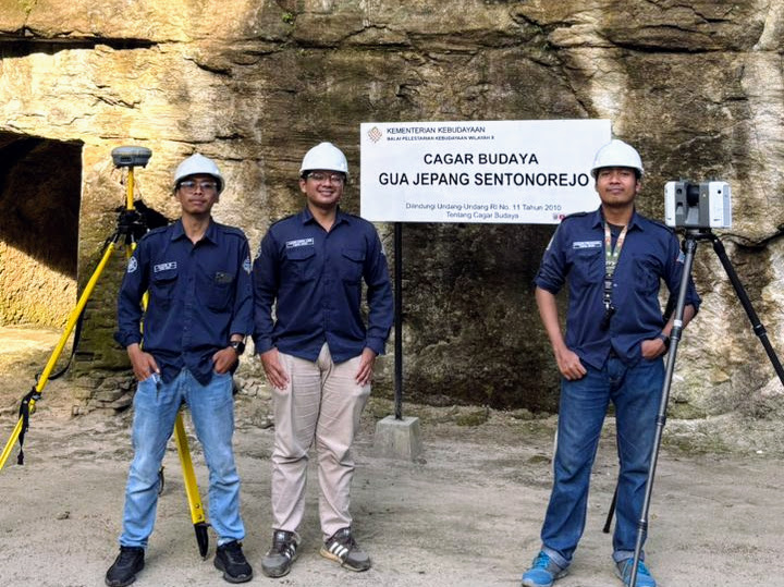
On December 12, 2025, four students from the Department of Geomatics Engineering at Universitas Gadjah Mada Vocational College—Pawana Abdurrahman, Rasyid Widayanta, Marcelinus Palma Surya Valendra, and Fakhri Fairuz Azmi—conducted a data acquisition activity at the Gua Jepang Sentonorejo cultural heritage site using the Trimble R8s Global Navigation Satellite System (GNSS) and the Leica RTC360 Terrestrial Laser Scanner (TLS). The activity was part of the support provided by the Center of Excellence Smart & Green Building Information at UGM Vocational College in advancing applied research, vocational education, and the digital preservation of cultural heritage. All equipment used in the activity was provided by the CoE Smart & Green Building Information.
Gua Jepang Sentonorejo is located in Blambangan, Jogotirto Village, Berbah Sub District, Sleman Regency, Special Region of Yogyakarta. The site is a historical relic built during the Japanese occupation of Indonesia and was used at the time as an ammunition storage facility. It is now considered part of the nation’s historical heritage that should be preserved.
The purpose of the data acquisition activity at Gua Jepang Sentonorejo is to digitally document and preserve cultural heritage through the use of laser scanning technology and three-dimensional modeling. This approach enables the cave’s shape and structure to be recorded accurately and in detail in a digital format, allowing the data to be utilized for conservation, educational, and research purposes. In addition, the digital model serves as a long-term archive that is essential in addressing potential physical damage to the site caused by natural or human factors.
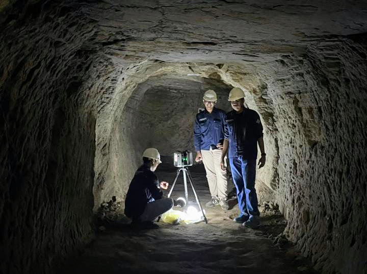
During the activity, the Trimble R8s GNSS was used to obtain control point coordinates in the Gua Jepang Sentonorejo area, which were subsequently utilized to align the three-dimensional data with a global coordinate system. Meanwhile, the Leica RTC360 Terrestrial Laser Scanner (TLS) was used to record the cave’s morphology, generating point cloud data. The point clouds were then processed through registration, filtering, and georeferencing stages to produce an integrated dataset that serves as the basis for the 3D modeling of Gua Jepang Sentonorejo.
Through the activity, the Center of Excellence Smart & Green Building Information provided tangible support for the development of research and construction technology, particularly in the utilization of GNSS and laser scanning technologies for the documentation and modeling of historical buildings and sites. The initiative aligns with the center’s vision of becoming a pioneer in the development of smart, green, and sustainable construction technologies while strengthening the synergy between research, education, and industry needs.
Penulis – Dyah Ajeng Wijayanti