Bantul, April 7, 2026 — Students of the Applied Bachelor Program in Surveying and Mapping Technology, Sekolah Vokasi, Universitas Gadjah Mada, conducted Terrestrial Laser Scanner (TLS) and Global Navigation Satellite System (GNSS) data acquisition as part of their research activities. The activity took place on April 6–7, 2026, at Palbapang Station, Bantul.
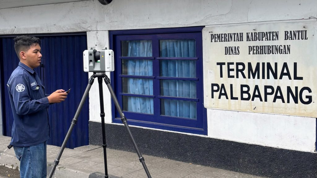
The activity was carried out by Marcelinus Palma Surya Valendra together with three other students as part of a survey team, utilizing surveying instruments provided by the Center of Excellence (CoE) Smart and Green Building Information. Data acquisition was conducted using the Leica RTC360 Terrestrial Laser Scanner (TLS) to obtain three-dimensional spatial data, and the Trimble R8s GNSS receiver for control point measurement.
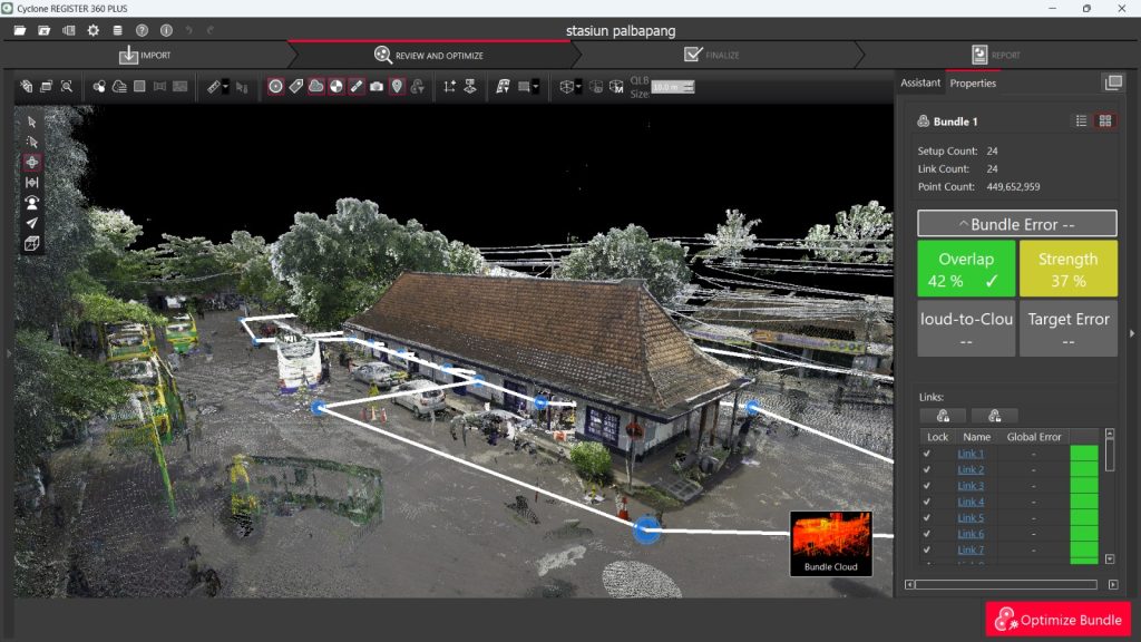
TLS data acquisition was performed through multiple scan stations to generate a high-density point cloud dataset. This method enables detailed and comprehensive recording of objects in the form of three-dimensional models, supporting documentation and modeling of existing site conditions.
Meanwhile, coordinate measurements were carried out using the static GNSS method. In this method, the GNSS receiver is positioned at a fixed point and remains stationary over a certain observation period to collect satellite signal data, particularly carrier-phase observations. The collected data were then processed using post-processing techniques to obtain high-precision coordinates. The static method generally provides higher accuracy compared to rapid observation techniques, making it suitable for establishing control points.
The processed GNSS coordinates were then used as ground control points (GCPs) in the georeferencing process of the TLS-derived point cloud data. This ensures that the resulting 3D model is not only geometrically detailed but also accurately referenced within a global coordinate system.
Through this activity, students gained practical experience in integrating TLS and GNSS technologies, from data acquisition to processing and georeferencing. The activity is expected to enhance students’ competencies in surveying and mapping, particularly in the application of geospatial-based 3D modeling technologies.
Penulis – Dyah Ajeng Wijayanti