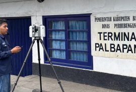
Bantul, April 7, 2026 — Students of the Applied Bachelor Program in Surveying and Mapping Technology, Sekolah Vokasi, Universitas Gadjah Mada, conducted Terrestrial Laser Scanner (TLS) and Global Navigation Satellite System (GNSS) data acquisition as part of their research activities. The activity took place on April 6–7, 2026, at Palbapang Station, Bantul.
CoE Smart and Green Building Information
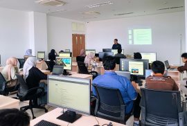
Yogyakarta — Students of the Applied Bachelor Program in Surveying and Mapping Technology, Sekolah Vokasi Universitas Gadjah Mada, conducted the Class A Terrestrial Photogrammetry Practicum on Wednesday, March 11, 2026. The activity took place in Room 504 of the Center of Excellence Smart and Green Building Information, Teaching Industry Learning Center Building.
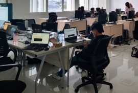
Yogyakarta, March 6, 2026 — The Building Information Modeling (BIM) Community of the Civil Engineering Department (DTS) at Universitas Gadjah Mada Vocational College once again organized a regular training program aimed at enhancing the skills of its members. This session specifically focused on the application of BIM software in quantity takeoff and construction cost estimation.
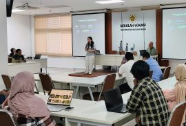
The Center of Excellence (CoE) Smart & Green Building Information at Universitas Gadjah Mada Sekolah Vokasi UGM successfully organized a Building Information Modeling (BIM) training on road infrastructure on January 27 and 29, 2026. The activity was held in Room 504 of the Teaching Industry Learning Center (TILC) Building, Sekolah Vokasi UGM. The training was attended by five participants from various groups within the Sekolah Vokasi UGM, including students, academic staff, and lecturers from the Department of Earth Technology and the Department of Civil Engineering. The program aimed to enhance participants’ understanding and skills in applying BIM technology for road infrastructure planning and modeling.