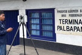
Sleman July 28th 2026 – The Center of Excellence (CoE) for Smart and Green Building Information (SAGEBIM) at the School of Applied Sciences of Universitas Gadjah Mada (SV UGM) is solidifying its position as a hub for digital construction solutions. By leveraging cutting-edge Terrestrial Laser Scanner (TLS) technology, CoE SAGEBIM is showcasing its capacity to provide high-precision 3D scanning services for as-built building evaluation, a vital instrument for audit, maintenance, and modern infrastructure management.