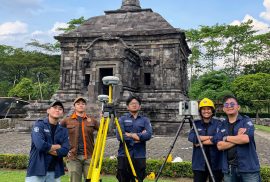
Sleman — Students from the Department of Geomatics Engineering at the Universitas Gadjah Mada Vocational College (SV UGM) conducted a data acquisition activity as part of their final project titled “3D Modeling of Banyunibo Temple Based on the Integration of Terrestrial Laser Scanner and UAV Photogrammetry for Digital Documentation.” The activity was carried out on 25–26 April 2026 at Banyunibo Temple, Prambanan, Sleman, Special Region of Yogyakarta .
3D modeling
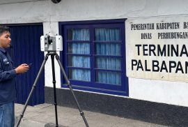
Bantul, April 7, 2026 — Students of the Applied Bachelor Program in Surveying and Mapping Technology, Sekolah Vokasi, Universitas Gadjah Mada, conducted Terrestrial Laser Scanner (TLS) and Global Navigation Satellite System (GNSS) data acquisition as part of their research activities. The activity took place on April 6–7, 2026, at Palbapang Station, Bantul.
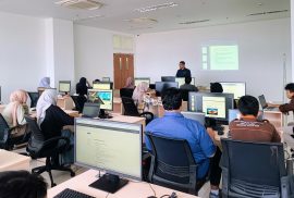
Yogyakarta — Students of the Applied Bachelor Program in Surveying and Mapping Technology, Sekolah Vokasi Universitas Gadjah Mada, conducted the Class A Terrestrial Photogrammetry Practicum on Wednesday, March 11, 2026. The activity took place in Room 504 of the Center of Excellence Smart and Green Building Information, Teaching Industry Learning Center Building.
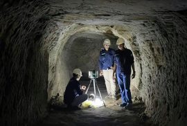
On December 12, 2025, four students from the Department of Geomatics Engineering at Universitas Gadjah Mada Vocational College—Pawana Abdurrahman, Rasyid Widayanta, Marcelinus Palma Surya Valendra, and Fakhri Fairuz Azmi—conducted a data acquisition activity at the Gua Jepang Sentonorejo cultural heritage site using the Trimble R8s Global Navigation Satellite System (GNSS) and the Leica RTC360 Terrestrial Laser Scanner (TLS). The activity was part of the support provided by the Center of Excellence Smart & Green Building Information at UGM Vocational College in advancing applied research, vocational education, and the digital preservation of cultural heritage. All equipment used in the activity was provided by the CoE Smart & Green Building Information.